

Hiking the Caucasus: Georgia’s white mountain wall an unbeaten path into snowy heaven
MESTIA, Republic of Georgia — Flying isn’t fun anymore. Security takes longer than some Netflix series. The shrinking seats are comfortable only for gymnasts. Nothing on board is free except for the anguish hoping the bag you paid $50 to check actually arrives when you do.
Then there are the flights that make you never want to come down.
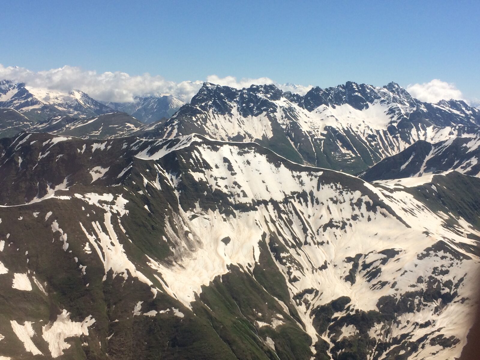
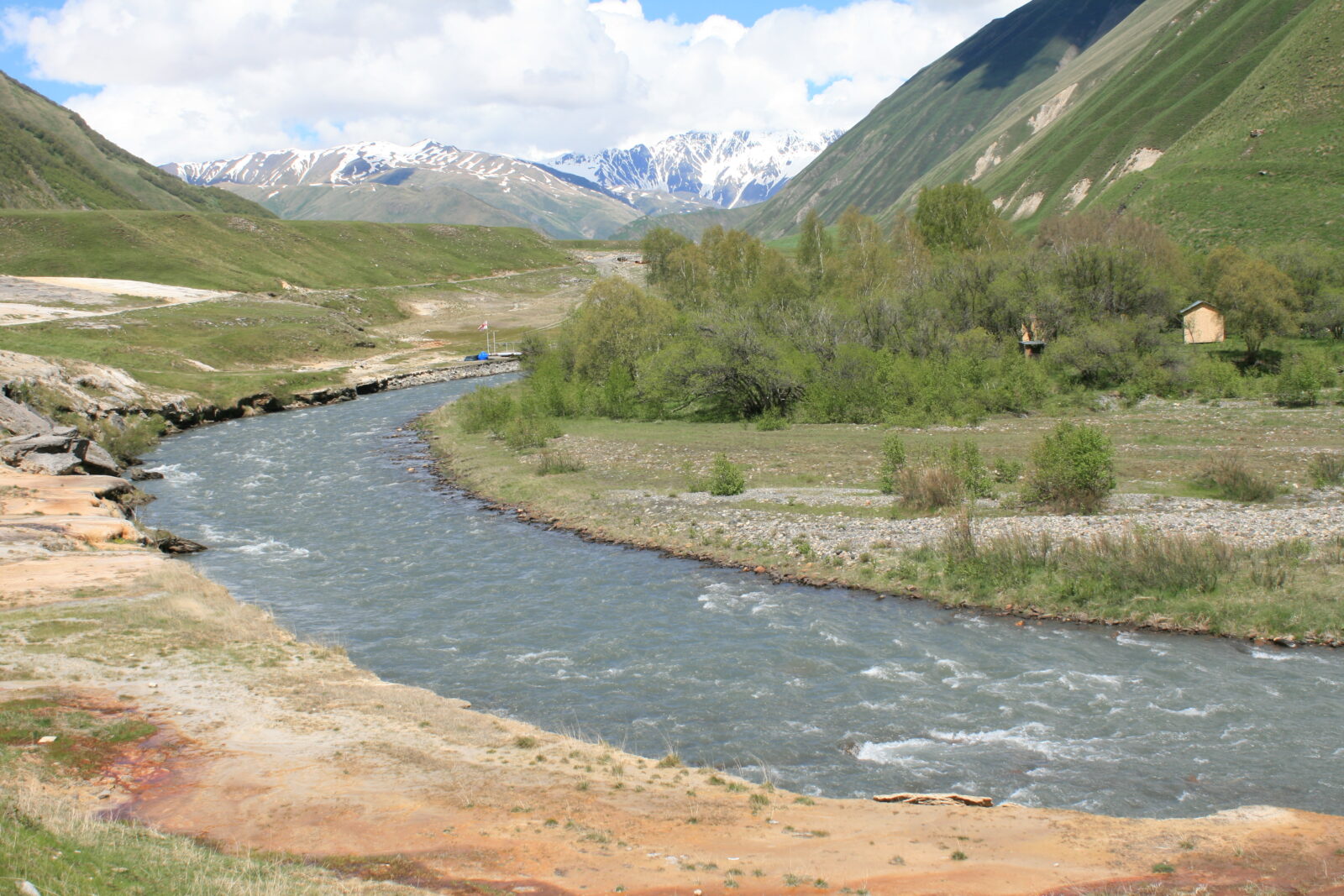
From the time we took off to the time we landed, the mountains stretched like a white-frosted layer cake. For 50 minutes I got an up-close-and-personal look at real-life topography. I had to peer up from under the airplane wing to see the tops of the mountains they were so tall. The snow piled high on the jagged peaks, cascading down until melting into green forests spliced by long, silvery creeks.
In a short time I’d be walking into the heart of those mountains.
Except for a special Nepal Airlines flight that took me past the peak of Mt. Everest in 1987, no flight in my life matched the regularly scheduled Vanilla Sky journey from Tbilisi to Mestia, into the heart of the Great Caucasus mountains. On a planet with the Himalayas, Andes and Alps, the Caucasus don’t get much hype, like the Republic of Georgia in which it sits. But they have many unbeaten paths worth beating.
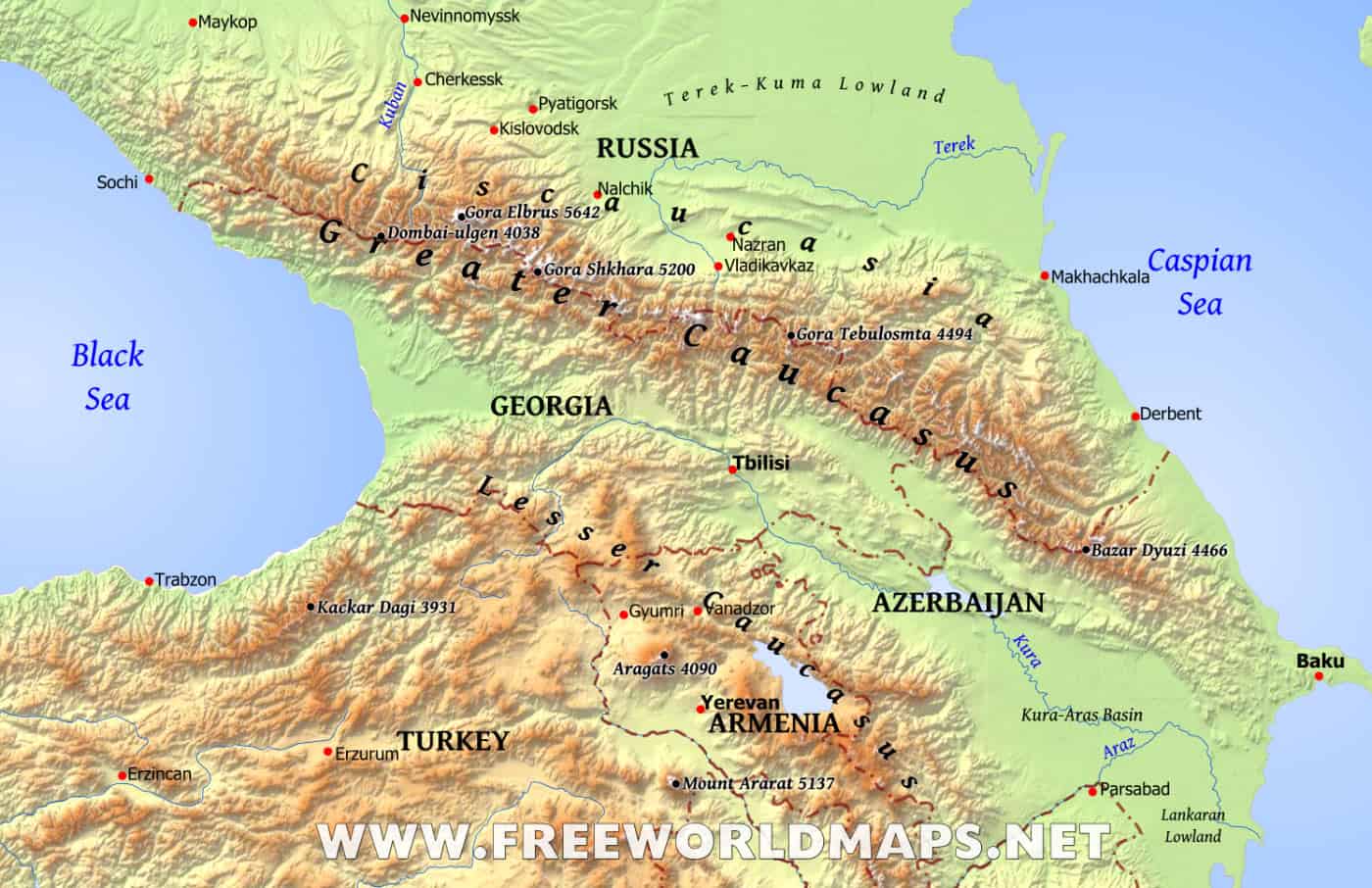
The Caucasus, which stretch 1,200 kilometers from the Caspian Sea in the east to the Black Sea in the west, separate Georgia from old mother Russia like a long line of security sentries. Conflicts between the two countries, as recently as 2008, left Georgia with bad public relations and the crude hiking trails void of the parades that stamp through the Alps, Himalayas and Rockies.
But oh, look what they’re missing.
“I’ve never seen these mountains this clear.”
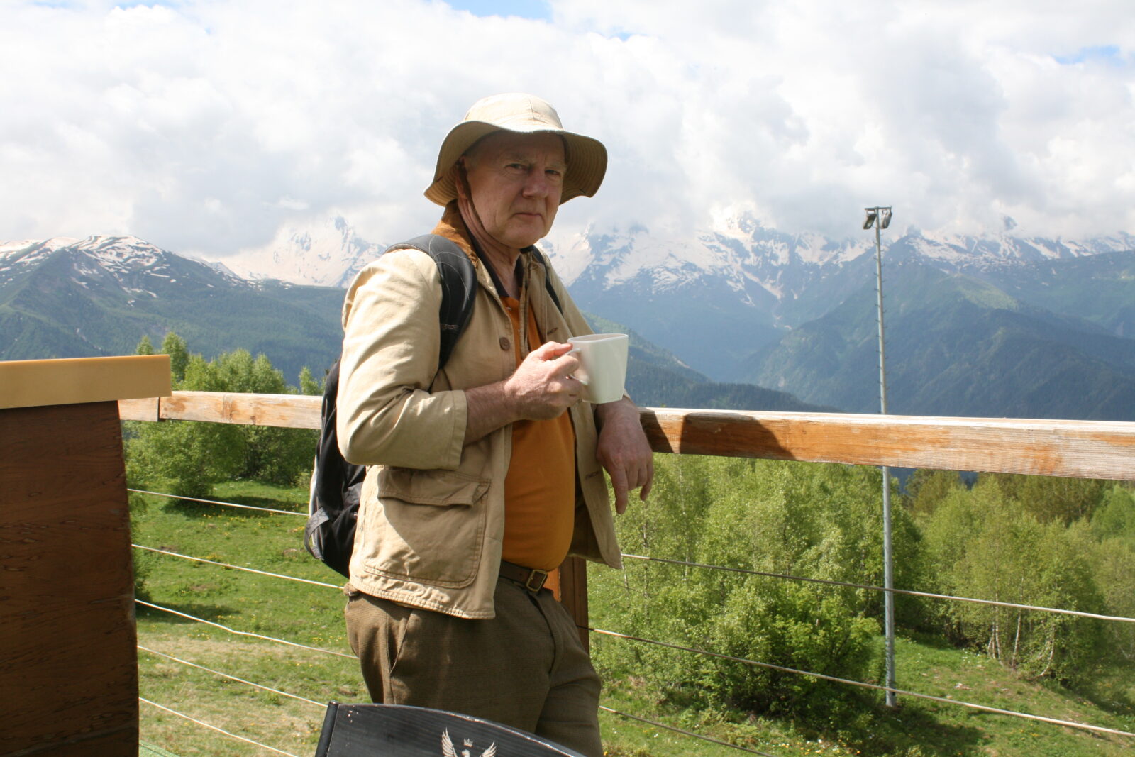
The voice came from the seat behind me, from the man who put Georgia hiking, literally on a map. Many maps, as it turns out. I believe man determines his own fate but sometimes luck just falls upon people, like a travel writer venturing into a land he knows little about. I happened to be sitting one row in front of one Peter Nasmyth. He’s an Englishman who is the godfather of Georgia hiking. He wrote two editions of “Walking in the Caucasus: Georgia,” the first and, apparently, only hiking guide to the country.

Nasmyth has bounced between London and Georgia for the last 30 years, first arriving when it was under the oppressive yoke of communism, when protests in the capital of Tbilisi were handled with a swift stroke of the Soviet sword. He sought peace in the Georgian countryside and over the years bushwhacked and tramped all over the country. I found his excellent book, complete with color photos and detailed maps of 53 hikes, in his equally lovely Tbilisi English-language bookshop, Prospero’s Books.
Short, chunky and balding, Nasmyth doesn’t look like your prototype hiking guide, a stereotype he quickly dashed with “People often think they’re fit because they do three sessions a week in the gym, but I often find reality very different.”
We got on well. He worked as a journalist for many years and views Georgia not through the prism of a PR man trying to protect his adopted country but as a crusty insider who can carve up the country with his tongue when needed. If I could’ve picked the perfect source to land on the same plane, it would be him.
The weather was spectacular. It was high 60s, dry and clear. My plan to kick back and re-charge the first day went south with Nasmyth’s rising enthusiasm.
“I have to take advantage of this great weather,” he said as the plane maneuvered into the narrow valley that held Mestia’s tiny airstrip.
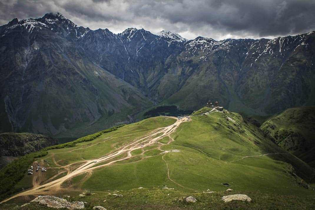
He kindly agreed to let me tag along and after checking into the charming Roza’s Guest House on the edge of town, I met Nasmyth at Leila’s, Mestia’s legendary restaurant/bar/dancehall/town pulse in the leafy piazza. It was nearing 1 p.m. and we didn’t have time for one of his legendary hikes so we did a short recon mission toward what is called the TV Tower.
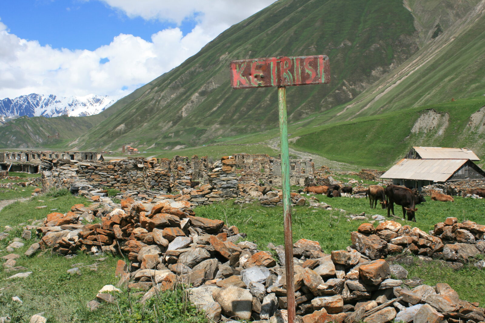
We saw it on the flight in. On a high green plateau, covered in forest and topped by a chairlift, was a long green clearing that led to a high TV tower at the end of the plateau. We walked through Mestia and past these large stone towers that dotted the entire town like giant matchsticks. Mestia is the capital of the Svenati region, home of the Svans, a Georgian ethnic group once famous for their blood feuds. These 175 towers, known as koshkebi, were built between the 9th and 13th centuries to house the Svans in case of foreign attack. The Svenati was never conquered, maybe not so much because of the koshkebi but because Mestia is so damn hard to reach.
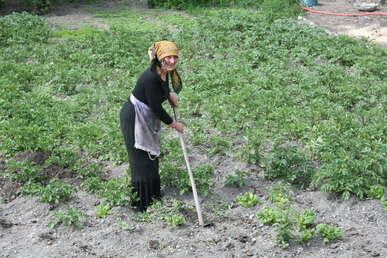
This is home to the Greater Caucasus, the highest section of a range with six mountains topping 5,000 meters. In fact, 40 percent of Georgia is over 900 meters, making Georgia one of the few countries in the world comfortable to travel in July.
As we reached the edge of town, we turned onto a narrow paved road that snaked up the mountain to the ski lift.
“Two and a half years ago, there was no road here,” Nasmyth said. “In the ‘90s there were no tourists. You’d hike three hours and suddenly you’d come to a shelter. The Soviets tried hiking across the Caucasus when there were no borders.”
Walking with Nasmyth was like walking with Lewis or Clark along the Oregon Trail. He knew every trail in Svenati and knew there were so many other trails to uncover.
“I wasn’t the first person to hike here,” he said, “but it feels like it.”
He talked about how his ventures into the wild flabbergasted his Georgian friends, who, like New Yorkers and the Empire State Building, never bothered to enjoy their mountains. “They’d ask me, ‘Why walk when you can drive?’” he said.
Nasmyth doesn’t just hike the Caucasus. He records them. No flower was too small to photograph, no trail to hidden to explore. His book has some shocking statistics. In a country the size of Ireland:
* Georgia has 2,000 glaciers.
* It has 4,000-4,500 species of vascular plants, or plants that contain minerals and water. Fifteen percent are endemic to the Caucasus.
* Until the Soviets invaded in 1921, more than 50 percent of Georgia’s population lived in the mountains.
* Even with so much land at elevation, its sea coasts, subtropical wetlands, semi-desert and volcanic plateaus landed Georgia on list of the world’s top 12 most diverse landscapes.
Like myself, Nasmyth has hiked all over the world, most notably the Himalayas and the Alps. But he keeps returning to Georgia, not just because there are enough uncharted trails to write more books but for the sheer solitude of it. I can confirm.
In five days hiking, I never saw more than 10 other hikers on a trail.
“I prefer it here because there is less people,” he said. “It’s difficult. It’s hard. There are big walks of 1,000 meters in elevation. Serious landscapes and a bridge won’t be there when it was before. There are times I’ve waded across rivers.”
As we climbed in elevation, with each turn of the road we saw a new, better view of the Caucasus on the other side of Mestia. We saw few cars and only two other hikers, both coming down. With each turn in the road we got a higher view of the long landscape of snow-covered peaks. It became a bit overcast and clouds had covered Mt. Ushba, one of the highest peaks at 4,710 meters, but it was still a magnificent scene, standing on a road and seeing all this snow high above you in June.
Nasmyth, after all these years, has yet to be jaded. He stood on the road, opened his arms wide to the scenery and said, “Even this simple hike, this is gorgeous!”
I asked him how he would describe hiking in Georgia.
“It’s like a beautiful woman who walks past and she keeps walking past,” he said.
I love interviewing the English. They all sound as if they just emerged from an MBA in English literature. I’m not into plants much, but after stopping and sniffing a bright yellow azalea and a bright magenta marsh orchid, I could see why Nasmyth spent so much time photographing flowers.
“It’s like walking into a perfumery,” he said.
The hike wasn’t terribly steep but, as I would find in Georgia, it was relentless. It never leveled. I’m fit for a 62-year-old. I go to the gym regularly. Nasmyth was a damn mountain goat. If he didn’t stop to photograph flowers, he would’ve left me in the concrete a long time ago.
He guides many hikes and privately chuckles when he hears about travelers who train by walking around their towns.
“You have to hike uphill,” he snapped. “Along flat, it’s crap.”
We reached one stop on the chairlift and decided to turn back, saving the rest for the next day. Two slacker dudes in hoodies listening to rock music that could be heard in Russia put me on a chair and sent me down about 400 meters. Peter, meanwhile, hiked through head-high brush under the lift to get back into town. This guy was out there.
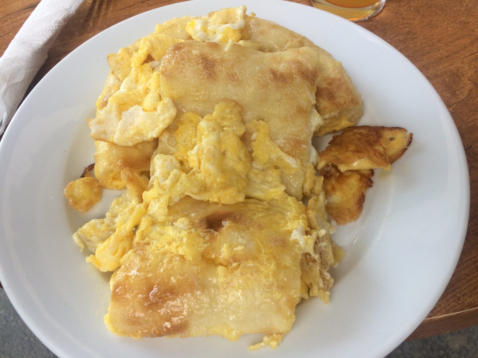
The next day we met at Leila’s where I dug into khikhlinko, a Svan dish made from bread fried in scrambled eggs that could get you to the top of any mountain in the Caucasus. I wondered why cafes near American ski resorts haven’t picked up the recipe.
Nasmyth and I gave ourselves a break and met at the base of the ski lift to take it up past where we hiked the day before. We were met by a group of middle-aged Latvians. It was by far the biggest group I’d see all week. And few of the hikers I met were Georgian.
“Georgia is just discovering that just as many people come here during hiking season as ski season,” Nasmyth said. “They think it’s so strange. I don’t mind. I’m the best promotion Georgia ever had for hiking. My book sells much better outside Georgia than inside Georgia.”
Georgia tourism is booming and people from all over the world come for its wine, as I wrote two weeks ago and food. So did I. But the hiking lags behind, both in promotion and assistance. Until 2 ½ years ago, the chairlift only worked in winter. The signage on the trails ranges between non-existent and Wherethehelldowego? Nasmyth has a Norwegian friend living in the mountains and is constantly out on the trail working on the markings.
“There are good markings, but they can’t maintain it,” Nasmyth said.
Fortunately for the directionally challenged hiker, such as myself who could get lost in an elevator, many hikes in Georgia are straight up and straight down. Some trails don’t have a lot of options.

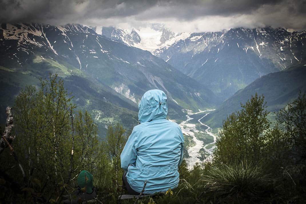
The TV Tower hike, however, is easy with the chair lift. It dropped us off at a cafe with an incredible panoramic view of snow-capped mountains. Huge jagged mountains to our right; emerald green meadows leading to another string of mountains to our left. In breaks in the trees fell little waterfalls. It was absolutely breathtaking and we hadn’t taken our first step.
The only sounds we heard, unfortunately, was the strains of rock music played by slacker dudes below.
The hike, past ruins of a discarded Soviet-era chairlift, is easy with little altitude gain but the views improved as we walked. To our left, the clouds had parted to get a good view of Ushba, its peak of 4,710 meters. Down below to our right stood a little village so far down its buildings looked like pinpricks dotting a meadow.
“At the bottom of Annapurna (in Nepal) there’s a village called Dhampus,” Nasmyth said. “It’s comparable. Only the view in the Himalayas is like this.”
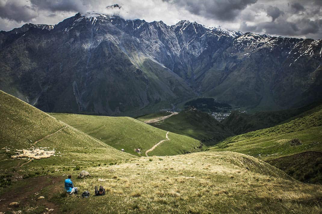
The TV tower hovering over the edge of the plateau is a good place to rest with views of Mestia to our left, the other village to our right and mountains bordering it all. It was like being inside a giant snow globe.
As I was getting up to return, Nasmyth made a disturbing sound. “Hmmm,” he said, like a guy who was considering something crazy. “I wonder how we could get down there.”
He pointed 1,000 meters below. A trail, as thin as a knife carving, led from the bottom of our plateau to a seemingly endless forest. I saw no trail down. He tried cutting through brush down the hill. He quickly came back.
“It’s a fake path,” he said. “If I slip, it’s a sheer drop all the way down.”
“OK,” I said, quietly relieved. “Too bad. Let’s go.”
“Wait. I see another path.”
He inched his way down about 15 meters while I sat looking at the view, wondering how good a beer at Leila’s would be.
“IT’S GOOD!” he yelled. “COME ON DOWN!”
I gingerly inched my way down about 50 feet of mud where I saw Nasmyth pointing down, straight down, into what seemed virgin jungle, the kind of landscape you see in science fiction movies about monsters eating children.
“See that trail there?” he pointed way below to the meadow. “If we can get down, we can get to that path, into the forest and to a village.”
Funny, I saw a path going into the forest but not out. I saw no path down where we stood. Knowing I had to write a travel article for mainstream readers, I decided a beer sounded better than scribbling my obituary as I’m lost forever.
Later that night, as I watched a Svan dance team swirl like dervishes at Leila’s, I saw Nasmyth. He said it took him eight hours from the time I left him to get down, into the forest, out of the forest, into a village and back to Mestia.
My hikes weren’t nearly that insane. Here are summaries of the three other hikes I took, all highly recommended, two of which require a good amount of fitness — and all requiring a damn good camera.
THE CROSS PEAK
Above the town of Mestia, on a high peak behind my guesthouse, rests a legendary cross. It’s 900 meters above the town and is the quintessential hike for anyone who visits Svaneti. You can see the cross from all over town and the peak is so high the cross looks like something that hangs from a necklace. In reality, it’s nearly 20 feet tall.
The signage for this hike is awful, which is why I spent 30 minutes with Nasmyth on my cell phone in a complete frenzy trying to find the trailhead. It’s a simple small road off the main drag and leads up — again, STRAIGHT up — under a stone arch and up a stone path. Not that this was rural, but I passed a cow resting next to someone’s home.
I continued up a gravel path where another unmarked fork led to one more phone call to Nasmyth, showing remarkable patience by not telling me to jump off a cliff and hanging up. Avoiding a shorter, but much steeper, path I veered right. What the path lost in grade it gained in views. A huge forest leading to distant mountains covered in snow dominated the horizon. Wildflowers of pink and yellow in fields of green. The only humanity I saw were two farmers tending to their horses.
It’s very steep, maybe a 20-degree grade. Leaving at 9 a.m. it was only about 70 degrees, yet sweat poured off my brow. I stopped every 50 or 100 meters to catch my breath. My words from my tape recorder come in heavy heaves.
But like most hikes, views give you energy and the Caucasus is one long adrenaline injection. At one point the trail breaks off about 15 feet around a tree. It stops there, offering a fantastic perch of Mestia, snow-capped peaks in the background. I bathed myself in a cool breeze. I heard the birds chirping. I kicked myself for not bringing a cooler full of beer. To hell with the cross. This was the highlight of the hike.
I was so wrong.
About a third of the way up, the path turns onto a service road from which you get your first glimpse of the cross since you left town. It’s still not that big, meaning I had a ways to go. But as the road started evening out, I came to a bend where I saw the massive white pyramid of snow-covered, 4,858-meter Mt. Tetnuldi towering above the trees, the cross, me, Mestia. It was absolutely mesmerizing.
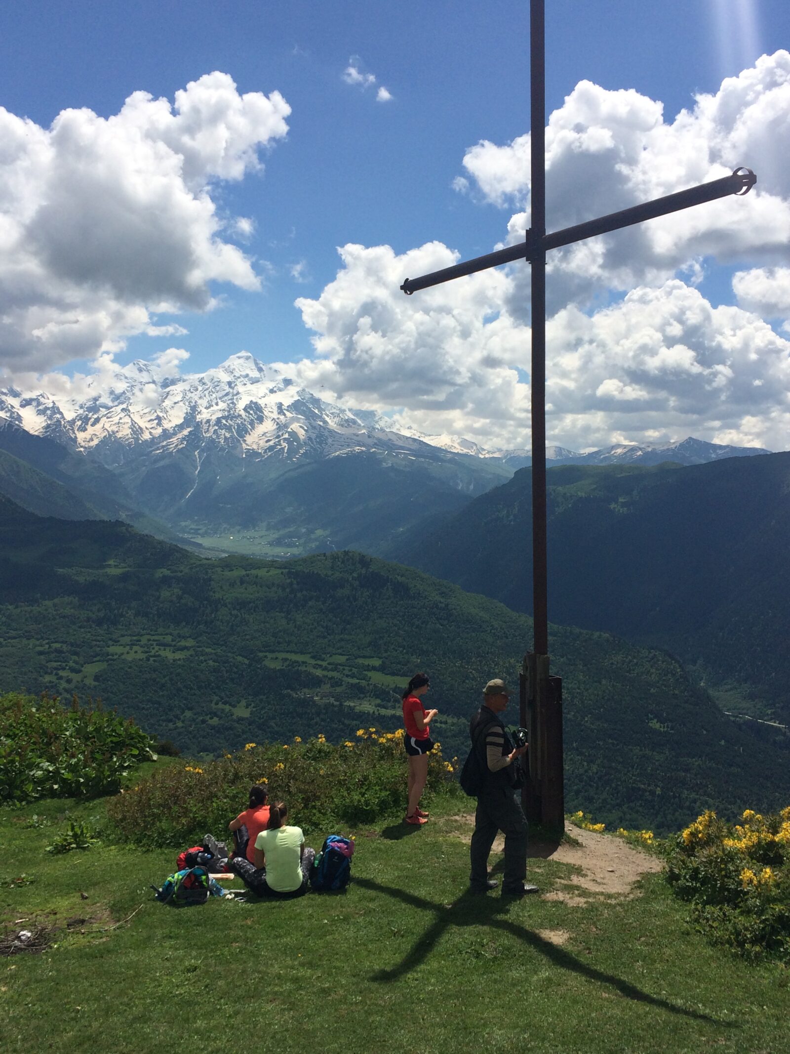
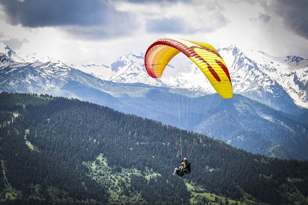
Then came a series of switchbacks, slowly inching my way up the cross and with each turn I saw a better view of the mountains. At 11:15 a.m., after two hours and 15 minutes, I arrived at the cross, sitting atop a huge flat grassy viewpoint, complete with a covered wooden platform for even better views. Some Asians, who’d taken buses up the service road, were paragliding all around me.
I couldn’t stop looking down, through the forest I just ascended into the meadows, the town of Mestia and the series of glaciers knifing through the giant snow-covered mountains. Behind me, with Ushda peeking through the occasional clouds, stood a little shelter hut that looked so small and insignificant in front of Ushda it could’ve been a matchbox.

After a quick picnic lunch, I continued toward the hut until the path ended but not before I photographed it with Ushda in the background. I celebrated with a toast of fresh, ice-cold water that came straight from the mountains through a pipe near the trail. Who needed beer?
I had the freshest, tastiest, most refreshing water of my life.
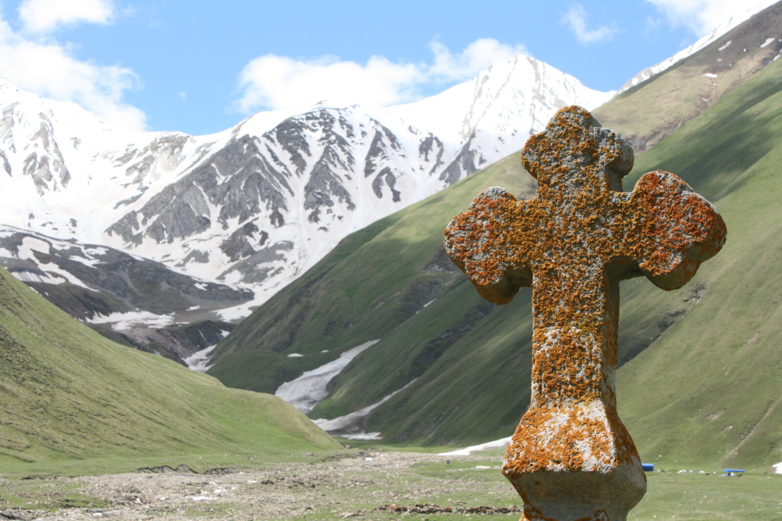
TRUSO VALLEY
The town of Kazbegi is 150 kilometers and three hours directly north of Tbilisi. If you miss your marshrutka stop, you’ll be in Russia. Kazbegi is Georgia’s poster girl. Every publicity shot you see shows this pleasant town in a valley under towering, majestic 5,033-meter Mt. Kazbek with Tsminda Sameba (Holy Trinity) church, looking so minuscule, on a hill in front of it 900 meters above Kazbegi.
To reach Kazbegi, I went to one of Tbilisi’s six marshrutka stations, known as moedani. They are Georgia’s equivalent of Times Square during a tsunami. It’s absolute chaos. I had to weave through a frantic, loud, crowded public market selling everything from cheap toys to industrial ice cream to find a row of marshrutky, a Georgian minivan, none of which had signs indicating destinations. I said, “Kazbegi” and an old man directed me to the back of a marshrutka where we waited 30 minutes to fill up its 22 seats and leave. It took an hour. Then again, the total ride cost all of 3 euros.
With Georgian pop music playing on the loudspeaker, we proceeded north on a beautiful journey. We passed long streams of water pouring down from mountains, green hills speckled with chalet-type hotels and restaurants, freshly planted trees protected by barriers. Near the town of Nadibani, a guy on horseback herded sheep in the thousands up the road, blocking our path. Two shepherds with curved canes plodded the sheep along while our driver patiently inched forward. Just another day in the Georgian countryside.
We soon approached the mountain range with snow packed on the side of the road. When we arrived in Kazbegi, I cursed myself for leaving my stocking cap at home in Rome, trying to lighten my backpack. Kazbegi was freezing. Forecasts called for the temperatures in the 30s. I bought a stocking cap at a souvenir stand for 20 lari (about 3 euro) and ate a wonderful juicy sawaha, a flatbread filled with meat, onions and sauce, huddled in my rain jacket.
The next day, however, caps weren’t needed. The sun broke out and temperatures were in the high 60s. The local tour company, Mountain Freaks, organized a van to take a group of travelers into the Truso Valley, 17 kilometers south of Kabegi, for 10 euros. The Truso Valley is just off the Georgian Military Highway, built by the Russians in the 19th century during its occupation of the Caucasus. It also is near South Ossetia, the mysterious breakaway republic that is Russian controlled and forbids Georgians, or anyone else but Russians, to enter.
The Truso Valley hike is flat, long and fascinating. Its 20-kilometer round-trip trail starts at a babbling brook with spectacular views of the snow-capped mountains. I wasn’t five minutes into the hike when I saw a man in all black smoking a black cigarette walking out of his stone house with a young boy in tow. He’s one of the few Ossetians who still live in abandoned villages and never resettled after South Ossetia broke away from Georgia in 2008.
Keeping my camera under wraps, we exchanged friendly, knowing nods,
The first hour was flat, following a pretty river with the mountains providing the perfect backdrop. But it is 2,175 meters and despite the easy terrain, I could feel the elevation.
Later I saw small herds of cattle tended by grim-faced Ossetians who come over to keep after their flock. Some cattle still roam the abandoned villages with stone shelters long gone empty. A small yellow shelter in a cluster of tall trees with the mountain background made for a pretty picture of calm in this star-crossed land.
Large stone Georgian Orthodox churches emerged from nowhere with tall, bearded priests dressed in all black standing outside with nothing to do. After a quick picnic lunch on a grassy knoll above the creek, I continued walking to the remains of Zakagori Fortress on a hill manned by Georgian soldiers sitting at their post. Before I even reached it, a Georgian soldier met me well before his post and told me to turn back. South Ossetia was just beyond the marker.
Yes, I might be able to get in but I might not get out.

TSMINDA SAMEBA CHURCH
John Meyer, an old Denver Post newspaper colleague and mountain climber, told me once he likes climbing mountains he sees all the time. You can see 5,033-meter Mt. Kazbek from anywhere in Kazbegi. It looms over the valley like the Matterhorn over Disneyland. For two days I walked past and under the mountain in my wanderings around Kazbegi until I filled my daypack with goodies and took off.
Kazbegi is a tough, technical, dangerous climb. The hike toward it is the lure and there are two routes: One, a road winds up from Kazbegi to the church at 2,200 meters, offering one of the best views in all of Georgia; two, hike to the church.
Crossing a river, I climbed through the village of Gargheta where I passed a small cafe and a ruined tower. That point leads to a trail that goes nearly straight up. You don’t need hand holds but the narrow, rocky path is steep. Fortunately, few people take this route in June and I never had to press against rock to let a family pass.
It took about an hour to reach the church. That’s where my solitude ended. In a grass makeshift parking lot sat six buses, all unloading hordes of Asians sprinting to the church and its viewpoints. I stumbled up, exhausted and took long draws of cold water as I saw the Asians not even look at the views. They only looked at the views through their cameras’ and cell phones’ viewfinders. One woman posed in about 10 spots on the church grounds, all with her hands out and her head rolled back, like some porcelain doll.
It is a breathtaking view. Along the church railing, I saw the sprinkled buildings of Kazbegi below and the snow-capped mountains stretching forever behind it. What a place for worship.

The church, lined with frescoes and carvings of dinosaurs, was built in the 14th century and used as a hiding place for treasures during foreign invasions. The Soviets built a cable car in 1988 to wing people to the church. But when communism fell in 1991, with no statues of Stalin to topple, the locals destroyed the cable car instead.
Tired of hearing Japanese and getting bumped by lenses and elbows, I continued up the hill toward Kazbek. I entered a huge forest and when I emerged at the top I looked back. A startling view was in front of me: the church, perfectly framed by huge mountains on the other side of the valley. The tour buses were thankfully far enough away to not enter my picture frame.
I continued past a herd of sheep, the views improving as I ascended. I finally saw another hiker, a young German woman who woke at dawn to hike to the Kazbek Base Camp another four hours away. I asked her how’s the view up above. She looked to the sky.
“The clouds have come,” she said. “You won’t see much in a few minutes. But the views this morning were wonderful.”
It was a good sign to return and at the bottom of the hike, I stopped at the little cafe right before the skies opened and rain pelted the trail I had just left. I had a long Natakhtari beer while four young Georgian men cooked chicken on small makeshift grills.
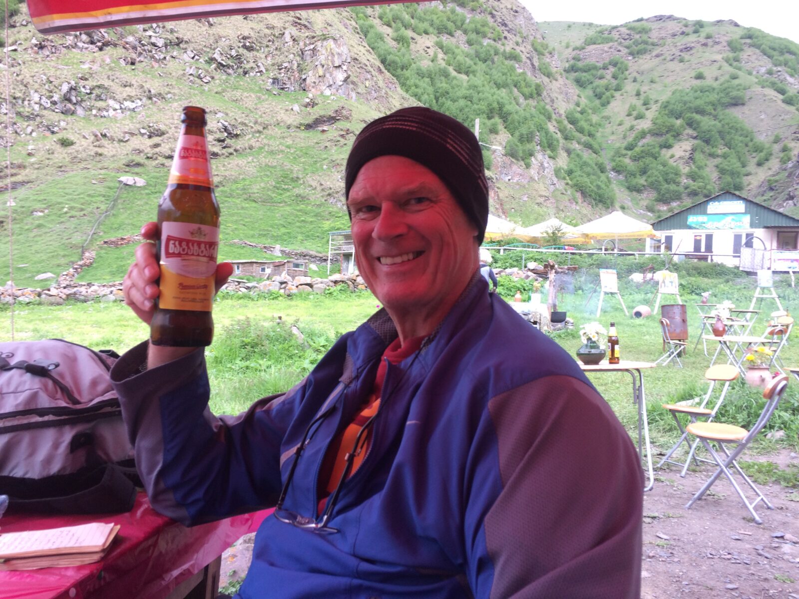
I raised my beer bottle: “Gagvimarjas!” I said. Cheers to the Caucasus and their trails that lead to corners of the earth so many will never know.
July 21, 2018 @ 12:54 pm
This is fascinating John. Yes, it sure seems you hiked trails that MOST travelers will never see. What a fabulous off the beaten path experience.